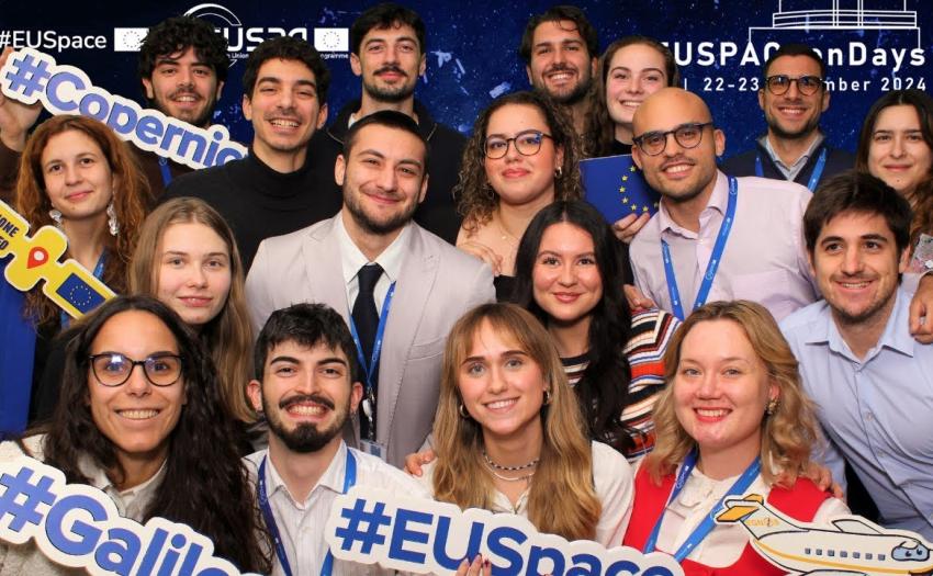
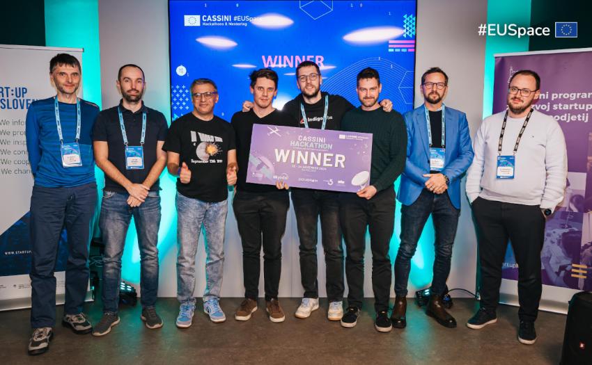
The European GNSS Agency (GSA) recently participated in the Satellite Masters Conference in Berlin, where it joined the discussions on Big Data, innovative applications, and the convergence of Earth Observation and GNSS.
The latest edition of the Satellite Masters Conference took place in Berlin from 20 – 22 October, including the annual Awards Ceremony for the European Satellite Navigation Competition (ESNC), the Copernicus Masters and a portfolio of conference sessions covering Earth Observation (EO) and Global Navigation Satellite Systems (GNSS). Major themes were Big Data, how to accelerate the development and realisation of innovative applications in the market, and the convergence of EO and GNSS.
Dorothee Bär of the German Federal Ministry for Transport and Digital Infrastructure, the host of the conference, set the tone during the Opening Session by highlighting how navigation and earth observation are key instruments of the digital age. Specifically, Bär sees a need to focus on downstream applications, which serve as the essential link between space technology and digital infrastructure on the ground – which is exactly where the GSA comes in.
EGNOS and Galileo Pave the Future
According to GSA Executive Director Carlo des Dorides, 2015 has been a busy year for Galileo, with successful launches and progress in the ground segment targeting the intermediate milestone of the launch of initial services in 2016. He also noted the excellent performance of EGNOS, which will soon enjoy enlarged coverage.
In particular, he highlighted the launch of LPV 200 capability in the aviation sector, which is already proving to be a major benefit in Europe and beyond. He also cited the concepts of smart cities, multi-modal logistics and the Internet of Things. “By 2020 it is anticipated that at least 50 billion ‘objects’ will be connected to the Internet,” he said. “Many of these will require positioning data services and applications.”
Matthias Petschke, Director of European Satellite Navigation Programmes at the European Commission, added that 6-7% of European GDP depends on the use of E-GNSS. Increasing the resiliency of these critical infrastructures would make a big difference, and Galileo will help. He also praised EGNOS, which he hailed as a true success story that was already making a huge difference in, for example, precision agriculture and civil aviation.
The European Commission’s Christoph Kautz gave an update on the two European GNSS programmes. As to Galileo, satellite launches are back on course, the ground infrastructure is expanding and the exploitation phase is now in sight with the target of 2017 and initial services in 2016. He also highlighted the decision to fund the next generation of EGNOS (V3) and extension of the service towards wide scale maritime and rail applications. He further discussed the European research and development funding for GNSS under the Horizon 2020 programme, along with the fundamental elements programme that aims to develop the chipsets and receivers Galileo needs to be in the market. In 2016, the Commission is looking to speed up market uptake through a variety of initiatives, and will also be looking to define strategic goals for the 2nd generation of satellites.
Hot Topics
Throughout the course of the conference, various panel discussions were held on an array of hot topics in the field of satellite navigation and earth observation. On the topic of Big Data, session moderator Jurry de la Mar of T-Systems said the world was experiencing a sensor revolution and managing all the data is proving a major challenge. “The data coming from EO operations over the next three years will be larger than the total collected by ESA in the last 30 years,” he said. “The key is to bring the user to the data, rather than data to the user, and for users to understand the semantics of the data. Handling this amount of data cannot be managed manually.”
One solution to the data overload is what Dr Manfred Krischke of CloudEO AG calls “geo-collaboration”. “Location based services are a key element of the sharing economy, enabling access to unused resources and saving costs,” he said. “Businesses should stop looking for the next killer app and start to make small apps that can be integrated with others via the geo-collaboration platform the cloud offers.”
Turning to Smart Cities, Stuart Martin of the UK’s Catapult Satellite Application declared it was the “Century of the City”. “The use of space data, along with GNSS, can have a massive impact on the development of Smarter Cities,” he said.
GNSS can also play an important role in creating Sustainable Solutions to Global Change. One example comes from the ESNC winner of Baden-Württemberg Challenge: ICARUS. ICARUS is a new global tracking service for small objects – birds and animals. Its aim is to monitor global migration, predict zoonotic diseases transmission and enhance climate modelling through a distributed animal-borne global sensor effort. Another example comes from the winner of the ESNC - The Netherlands Challenge and the University Challenge Special Prize, which uses GNSS monitoring of potential rain clouds over East Africa via low-cost receivers. The TAMHO project produces high resolution water vapour maps from GNSS signals that travel slightly slower through moist air. Low-cost receivers can measure this delay.
UAVs, or drones – always a hot topic at any GNSS event – was also discussed in Berlin. The panel highlighted two ESNC winners, including the overall Galileo Master Winner and also winner of the ESNC Valencian Community Challenge: POSEIDRON, a UAV for search and rescue and environmental defence using EGNOS and the Galileo SAR signal. Enrique JM Asensi saw applications in the current migrant crisis, as the vehicle can deploy a 70kg life raft, is 15 times cheaper than a helicopter and can be deployed in all conditions. The winning idea behind the ESNC - Switzerland Challenge and ESA Special Prize – RTKNAV – was described by Zhenzhong Su as a low cost, compact, real-time centimetre accuracy navigation solution. Its target market is high precision agriculture apps, UAVs, mobility, sport and health applications. “RTKNAV provids affordable, high precision for the mass market,” said Su.
Safety and security are two important topics to the Galileo programme, and the Disaster and Security session focused on Galileo for Security Search and Rescue opportunities. Kai Herrmann from the German Competent PRS Authority sees PRS as the EU’s strategic answer to the security challenges of our digital society. Specifically, he sees applications in secure services for emergency services and critical infrastructure as well as access control, spoof resistance and contributions to data security and data privacy, local authentication and traffic management applications.
An example of one of these applications came from Prof Mattia Giovanni Crespi from the University of Rome 'La Sapienza' and Dr Gabriele Colosimo from Leica Geosystems, who described the VADASE project that uses real-time monitoring of GNSS signals from a standalone receiver to monitor seismic events in real time. The idea won the 2010 ESNC DLR special prize, and Leica Geosystems launched the product this year with a VADASE engine able to compute seismic displacements in real time autonomously.
Another example came from Jukka Talvi, who described the HALI initiative from the northern Finnish city of Oulu, which won the ESNC - BMVI / BMWi Special Prize for its system that speeds emergency vehicles through green lights and has dramatically improved response times and safety. The system is currently being extended to the rest of Finland and perhaps the rest of Europe.
Media note: This feature can be republished without charge provided the European GNSS Agency (GSA) is acknowledged as the source at the top or the bottom of the story. You must request permission before you use any of the photographs on the site. If you republish, we would be grateful if you could link back to the GSA website (http://www.gsa.europa.eu).