Urban Development and Cultural Heritage
EO and GNSS are invaluable tools for the transition to smart, connected and climate neutral cities. City authorities, urban planners, real estate agencies, cultural heritage managers and surveyors all use solutions powered by EO and GNSS to perform a wide range of applications.
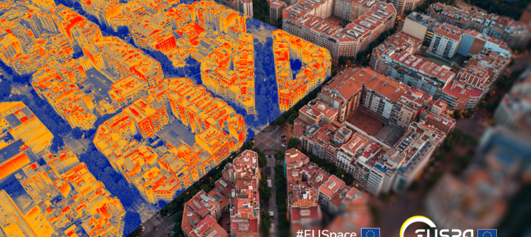
The Copernicus Sentinel constellation for instance, delivers high-quality free satellite imagery that allows for the estimation of characteristics related to urban structure. Moreover, the Copernicus Atmosphere Monitoring Service generates essential information on air quality in urban environments, measuring particles that might affect the heath of citizens and monitoring greenhouse gas emissions. This is also critical when monitoring cultural heritage sites, whereby the impact of air quality and potential ground subsidence may become catastrophic.
EGNSS-based solutions are also used, in conjunction with EO, to accurately survey and map urban areas and to build advanced 3D models of the built environment.