European GNSS: Providing Access to EU Citizens
Disclaimer
This page has been archived and is provided for historical reference purposes only. The content and links are no longer maintained and may now be outdated.

GNSS-enabled technology is set to be a game changer. But to succeed, it must be accessible and user friendly. How to accomplish this was a topic of discussion at the Geospatial World Forum 2014, held in Geneva May 5 – 9.
According to Sally Fegan-Wyles, Assistant Secretary General United Nations Director-UNITAR Switzerland, 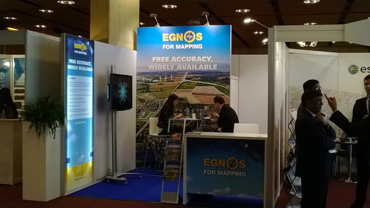 GNSS-enabled technology is positioning itself as a game changer. However, to reach its full potential, the solutions developed must be made widely accessible and the user given the knowledge needed to use the technology.
This is what the European GNSS Agency (GSA) aims to do.
“Our goal at the GSA is to provide true benefits to European citizens,” said GSA Executive Director Carlo des Dorides, speaking during the geoSMART & Infrastructure Development plenary session at the Geospatial World Forum 2014 in Geneva, Switzerland. “With the European GNSS market rapidly expanding – with thirty percent of the receivers being already Galileo enabled – it is important that we continue to support the user’s ever-evolving needs.”
The Geospatial World Forum conference and exhibition showcases the many innovations carried out using geospatial tools. It attracts top management executives from both the public and private sectors and such user segments as land management, environment, constructions, defense, utilities, agriculture, spatial data infrastructure and business enterprise. The event counted with 30 collaborative partners, Ministerial and Administrative leadership, 250 Head of Organisations, 75 countries, more than 250 speakers with more than 30 moderators and an estimated participation of 1000 delegates.
In addition to the GSA Executive Director Carlo des Dorides participation in the plenary session, the GSA was also present in a booth where the ‘EGNOS for Mapping’ display was brought to the exhibition and visitors had the opportunity to further understand EGNOS – but also future Galileo´s - added value in the geospatial sector.
In a filmed interview with Geospatial Media & Communications Alejandra Martinez, GSA expert stated that “EGNOS is used by 2/3 of farmers that are using GNSS and is helping, among others, by eenhancing precision than achieved through GPS alone, saving time, reducing fatigue of farmers, optimising crop yields and increasing profit margins. Therefore, we encourage farmers to use Precision Farming benefiting of EGNOS”
Powered by EGNOS and Galileo
The driving forces behind this effort to empower the user are EGNOS and Galileo. EGNOS is already having a significant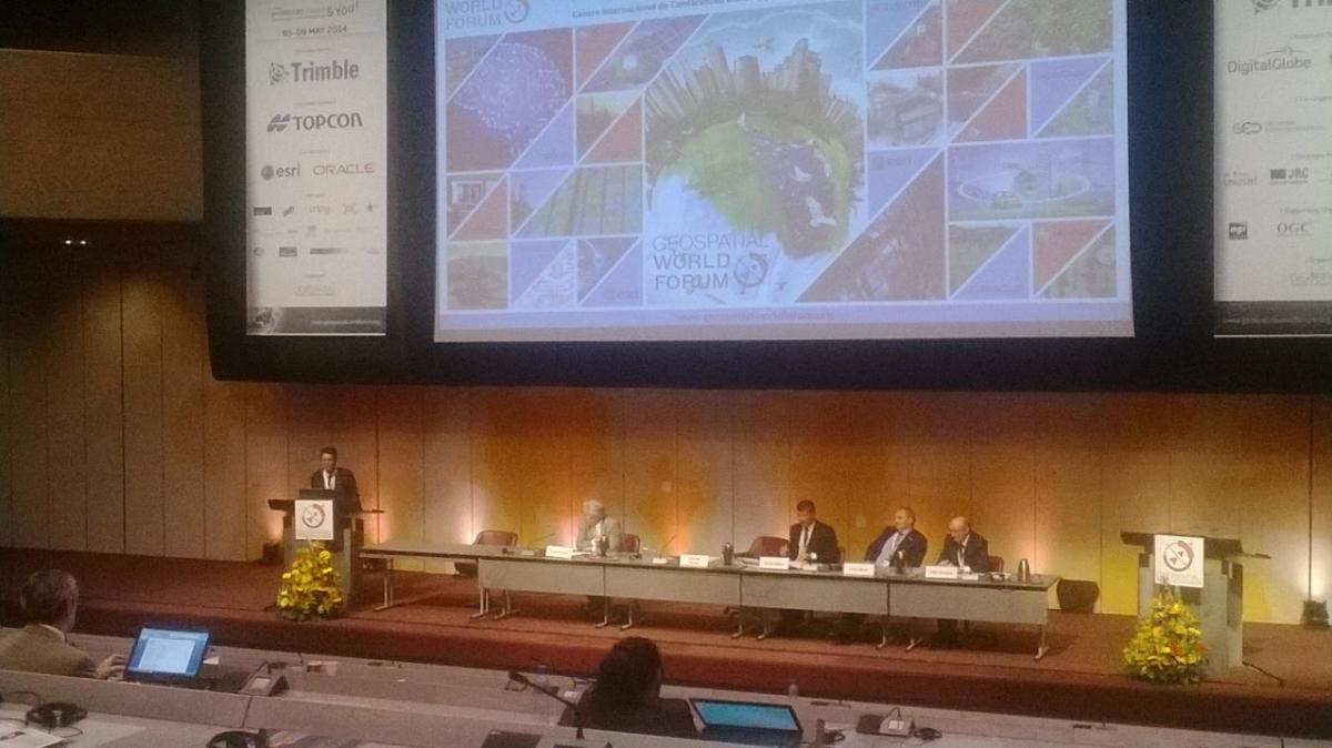 impact on the market – particularly in the aviation sector, where it is quickly complementing traditional navigation systems. Galileo, on the other hand, is a global service offering similar characteristics as the American Global Positioning System and full interoperability with it.
“An extensive testing campaign has proved that Galileo is performing very well,” remarked des Dorides. “We are expecting numerous satellite launches this year, with two satellites having been shipped to the launch site this week, which will allow us to launch Galileo Early Services.”
Also speaking during the plenary session was Chris Gibson, Vice President of Trimble USA, who noted how his company is already taking advantage of the Galileo Open Service signals. “Our Trimble 360 receiver technology is capable of tracking Galileo satellites,” he noted.
Supporting Access
In addition to the aviation sector, des Dorides noted growing interest from other sectors, such as road and survey/mapping. “The road sector is very promising as many cars are now manufactured with embedded GPS systems, and the accuracy of EGNOS makes it a popular choice in the survey and mapping sectors,” he said. “Both of these areas are excellent examples of how European citizens can use and benefit from EGNOS today and soon Galileo.”
To illustrate, des Dorides noted that, in the road sector, the majority of GNSS chipset and receiver manufacturers are already prepared to launch Galileo ready products, which will only further increase user access. On the surveying and mapping side, the GSA is seeing more and more non-traditional surveyors approaching the market, including those working in the environmental and engineering sectors.
To further support user access across all segments, des Dorides highlighted such European Research and Development Programmes as FP7 and the current Horizon 2020. “The aim of these funding programmes is to improve access, and judging from past projects and current funding applications, this is exactly what is happening,” he said.
The three EU-GNSS FP7 calls resulted in 10 patents/registered trademarks, 33 commercialized products or services and 69 working prototypes – with more expected. Of particular interest is how much of the EU-GNSS funds went towards supporting Small and Medium Enterprises. Forty percent of all allocated GNSS funding went to SMEs, compared to a 15% EU FP7 average.
Likewise, the Horizon 2020 Framework Programme for Research and Innovation is likely to have a significant SME component. With the first call recently coming to a close, contracts are expected to be awarded by year end. A second call is expected in early 2015.
GSA Executive Director Carlo des Dorides
Media note: This feature can be republished without charge provided the European GNSS Agency (GSA) is acknowledged as the source at the top or the bottom of the story. You must request permission before you use any of the photographs on the site. If you republish, we would be grateful if you could link back to the GSA website (http://www.gsa.europa.eu).