Local Integrity: Characterization of GNSS Degradations in Urban Scenarios
Disclaimer
This page has been archived and is provided for historical reference purposes only. The content and links are no longer maintained and may now be outdated.

Safety-critical and liability-critical GNSS-based applications are needed to enable Intelligent Transport Systems and smart mobility. This requires trusted GNSS signals that are authenticated and of appropriate integrity. Assessing GNSS signal integrity in complex urban environments is not easy, but the GLOVE FP7 project has successfully demonstrated one possible approach that uses inter-vehicle communication to collate information on GNSS signal quality from a number of vehicles for assessing the local integrity.
To respond to user needs, a Global Navigation Satellite System (GNSS) must deliver reliable position and timing data to user applications. The user must be able to trust the information provided and be certain that its accuracy is within specified limits. This is especially true for safety-critical or liability-critical applications.
The level of trust that a user can place on GNSS signals is implied by authentication of the signal – i.e. an assurance that it is a genuine signal – and integrity parameters that relate to estimation of gross errors in the signal due to the space segment, the equipment characteristics and the operating environment.
As concepts for Intelligent Transportations Systems (ITS) and Intelligent Vehicle (IV) technologies are developed to help deliver major societal benefits in terms of smart and sustainable mobility, there is an increasing need to ensure that GNSS signal position integrity and authentication can be delivered to in-vehicular applications. GNSS-enabled applications, such as road user charging, pay-as-you-drive insurance and tracking of dangerous or high-value freight, require that highly accurate positioning data is available in all road environments. High accuracy and integrity will be essential for future applications, such as autonomous driving.
In Urban Canyons
In urban and other ‘non-open sky’ environments there are other challenges to signal-in-space integrity. These include limited satellite visibility as surrounding buildings cause multi-path signals and reception of other signals that are not ‘line-of-sight’, poor signal-to-noise ratio due to trees and other obstructions, and unintentional interference from other radio infrastructures.
For many positioning applications, the use of very accurate maps can satisfy user needs. However, for vehicle applications that require ‘lane level’ accuracy, this can be very difficult to achieve.
Space-Based Augmentation Systems (SBAS) such as EGNOS provide integrity for safety-of-life applications, such as aviation. Unfortunately, transferring this solution to other non-aviation transport scenarios is not straight forward – especially in the urban context. The ‘classical’ integrity approach for aviation is not practical for a ground-based vehicle, as in the air it is reasonable to assume open-sky visibility, which is not the case on the ground.
Clearly, an enhanced solution is required.
Local Integrity for a Local Solution
Recent trends in GNSS-based applications point towards one alternative. The growing availability of multi GNSS constellations (Galileo, GPS, Glonass etc.), increasing integration of data from a variety of on-vehicle sensors and the development of inter-vehicle communication to exchange data could combine to provide local estimations of GNSS signal integrity.
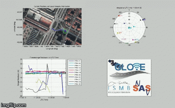
One of the aims of the GSA-managed FP7 GLOVE (GaLileo Optimization and VANET Enhancement) research project was to develop and demonstrate such a local integrity solution that exploits the potential of Vehicular Ad-hoc Network (VANET) infrastructures. The research team, led by the Istituto Superiore Mario Boella (ISMB) in Turin, shares and combines multiple observations of GNSS signals measured by different vehicles participating in a VANET.
VANETs are being developed to enable exchange of information between vehicles and roadside infrastructure that can, for example, be used to optimise intelligent traffic management and provide other useful information or entertainment services. GNSS and VANETs are two strongly related components within vehicle on-board units (OBU) with VANETs relying on position and time data and the VANET having the potential to make the GNSS positioning more flexible and precise.
The GLOVE approach effectively uses individual cars equipped with mass-market GNSS receivers as sensors for GNSS signal quality assessment. Data from collaborating vehicles is collected and collated via the VANET architecture and combined to characterise local spatial and temporal degradations of the GNSS signals.
By sharing GNSS data, a database of local integrity information can be generated and used to predict local GNSS signal degradations over time within an urban scenario. Centralised processing of GNSS measurements leads to a digital map (database) built from local information on GNSS signal quality. This in turn can be used to generate local protection level ellipses that are defined as Along-Track (AT), i.e. in the direction of travel of the vehicle, and Cross-Track (CT) directions. These protection levels are much more appropriate for vehicle applications with the CT level requirement being more stringent for lane positioning applications.
Proof-of-Concept
The GLOVE project has designed and assembled a measurement facility to collect real GNSS data in an urban context and carried out testing on the road in various dynamic conditions and a range of signal degradation environments. The analysis of data collected has validated the feasibility of this approach to local integrity assessment.
A GLOVE proof-of concept of local integrity and prototype demonstrator have also been designed, developed and installed in a Fiat 500. A real-time demonstration of the concept took place at GLOVE’s final project event on 11 December 2014 in Turin.
Over and above the demonstration of a solution for local integrity and augmented positioning for vehicles in an urban environment, the GLOVE project has shown that demonstrated integration of data from various sensor sources and contributed to the convergence of in-vehicle technologies.
These types of development will be critical to the future development of ITS and smart mobility.
Media note: This feature can be republished without charge provided the European GNSS Agency (GSA) is acknowledged as the source at the top or the bottom of the story. You must request permission before you use any of the photographs on the site. If you republish, we would be grateful if you could link back to the GSA website (http://www.gsa.europa.eu).