Harnessing the power of wind with EU Space
Europe has the potential to be a wind energy powerhouse. In fact, wind energy already provides approximately 20% of Europe’s electricity consumption – and that’s just scratching the surface. Some estimates believe Europe’s untapped onshore wind power alone has the potential to cover global energy demand until 2050.
While the answer to Europe’s energy problem may literally be blowing in the wind, there is a risk that it could all end up blowing away. That’s because Europe is not building enough wind farms to meet its target of having wind power provide 50% of its electricity by 2050.
According to WindEurope, the EU built 13 GW of new wind energy in 2024 – 11.4 GW onshore and 1.4 GW offshore. That’s far short of the 30 GW it needs to be building every year to reach its energy and climate targets.
Helping to fill this gap is the EU Space Programme!
In recognition of 15 June being Global Wind Day, here are a few of the many ways EU Space is helping Europe ramp up wind energy production.
From where to build to what to use
Wind energy companies want to know where the best place to invest their money is. Thus, choosing the right location for their wind farm is a prerequisite to efficient energy production, and EU Space data makes finding the optimal site easier.
For example, Copernicus data can be used to optimise the location of wind turbines. According to an article published by Copernicus Observer, by providing consistent, quality-controlled information about Europe’s past, present and potential future climate, Copernicus, and in particular the Copernicus Climate Change Service (C3S), has emerged as the tool of choice for selecting the right site for wind turbines.
Manufacturers can use similar Earth Observation (EO) data to design a wind turbine best suited for the identified site. According to EUSPA’s EO & GNSS Market Report, by using a combination of in-situ measurements and satellite imagery, turbine manufacturers can learn about the wind characteristics of a specific location. They can then use this information to assess the suitability and estimate the lifespan of various wind turbine types.
However, selecting the right site for a wind farm isn’t just about what’s good for the project, it must also consider what’s good for the environment.
As environmental considerations become increasingly stringent, EO data has emerged as an important tool for evaluating the suitability of specific regions for establishing wind farms. By harnessing the insights gained from space data, project managers can identify sites that have minimal ecological sensitivity and lower risks to biodiversity.
Gone with the wind?
You’ve probably heard of shooting the breeze, but stealing the wind?
Not only is wind theft a real thing, it is becoming a real issue as more and more wind farms are built.
According to an article published in Marine Policy, wind theft happens when one wind farm takes a significant fraction of the wind resources (i.e., wind speed) away from another wind farm located upstream and too close to allow for full wake recovery.
Needless to say, knowing the correct quantification of the resulting decrease in wind velocity is critical to accurately assessing potential energy yields of those sites placed in the wakes of existing ones.
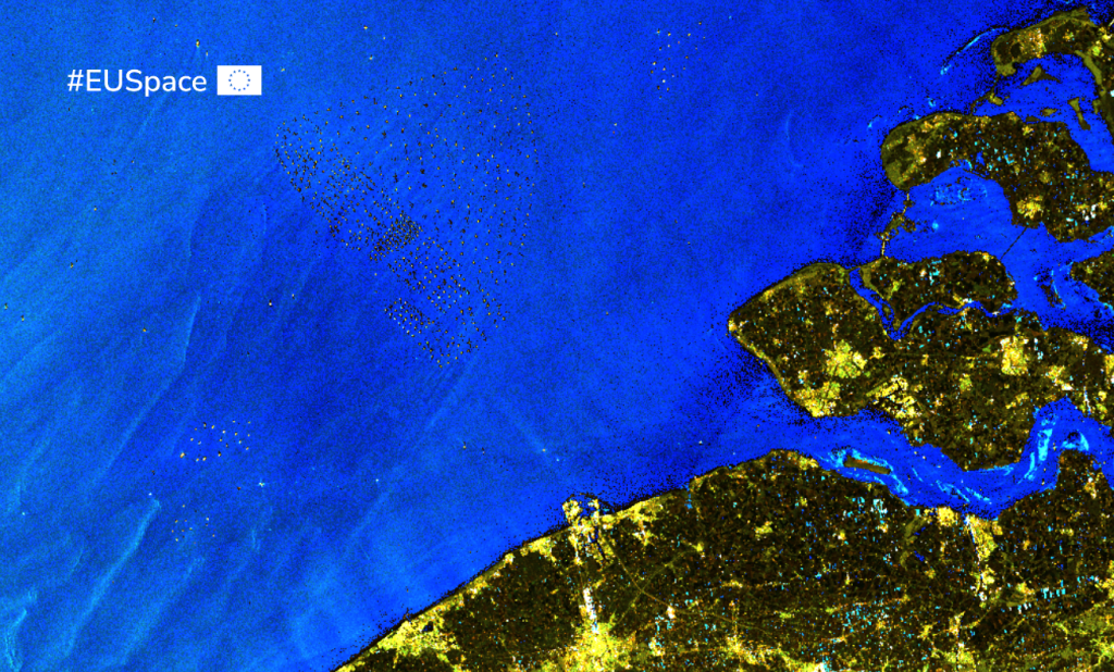
Satellite-based Synthetic Aperture Radar (SAR), is a powerful Earth Observation instrument that utilises radar waves interaction with the Earth's surface to collect detailed images, regardless of weather or daylight conditions.
As noted in the Market Report, satellite SAR data such as those provided by Copernicus Sentinel 1, is particularly useful for measuring wind speeds on the surface of the ocean. Wind farm project developers can leverage this information as a cost-effective way of assessing large areas for potential wakes created by existing wind farms.
Optimising operations with Earth Observation
After a site is selected and built, the next step is to get it up and running. Unfortunately, a number of challenges unique to the wind energy sector means this is easier said than done.
Amongst these challenges are constantly changing meteorological and atmospheric conditions, which can cause fluctuations in energy production. To illustrate, consider the offshore windfarms that dot the coasts of Belgium, Germany, Spain and Portugal. To optimise their operations, energy companies rely on high-quality information about wind variability – information that is made freely available via CS3.
Energy producers also rely on Copernicus data to accurately estimate the amount of energy a wind farm will be able to generate. For instance, grid and plant operators can leverage data on the availability of wind and other resources to more accurately determine which supply is likely to be more abundant. Based on this information, they can balance the resources they can rely on and compensate for those that may not be producing at full capacity.
Using EO and GNSS to inspect and maintain wind infrastructure
Once the infrastructure is built and operational, it must be maintained – something that becomes all the more challenging when the wind turbines are located offshore or in other difficult-to-reach and remote locations.
Here too Earth Observation can help.
Speaking during a recent episode of the EOcafe, a representative from the EO4WIND project explained how offshore operators use Earth Observation data to identify workability windows. Specifically, they look to data about ocean currents and weather forecast to decide whether they can safely get a maintenance crew out to an offshore site to fix a problem.
GNSS also plays a big role in wind turbine maintenance and inspection. The precise positioning services offered by Galileo and EGNOS, together with the latest developments in computer vision-aided navigation, enable the use of unmanned aerial vehicles (UAVs), or drones, to efficiently, effectively and safely inspect wind energy infrastructure.
GNSS-enabled drones are already being used to remotely inspect wind turbine structures. For example, Deutsche Windtechnik, a German wind farm operator, is using drones to inspect its offshore turbine blades, noting that doing so saves a significant amount of time compared to conventional inspection techniques. It also substantially reduces turbine downtime inspections.
According to the company, using drone technology to inspect rotor blades enables it to get a more complete picture of the entire exterior of the rotor blade compared to conventional rope access technology. Furthermore, the ability to determine the exact location of possible damage helps them precisely document the development of the damage, which Deutsche Windtechnik says can be very helpful for assessment purposes.
Helping Europe leverage the power of wind
From site selection to turbine design, installation, operation and maintenance, wind energy and space technology are converging to help Europe the leverage the power of wind.
As we celebrate Global Wind Day, remember, although we can't change the direction of the wind, with EU Space, we can use it to redirect our energy supply away from fossil fuels and towards renewable resources.
Want to learn more about EU Space for renewable energy? Be sure to download our free brochure
Media note: This feature can be republished without charge provided the European Union Agency for the Space Programme (EUSPA) is acknowledged as the source at the top or the bottom of the story. You must request permission before you use any of the photographs on the site. If you republish, we would be grateful if you could link back to the EUSPA website.