Space for Water: Turning the Tide with Satellite Tech
Under the theme "Space for Water", hundreds of innovators across 10 European locations (Austria, Bulgaria, Hungary, Italy, Netherlands, North Macedonia, Norway, Poland, Romania, Spain) spent a weekend transforming EU Space data into solutions for water management and protection.
The event, driven by the European Commission and EUSPA, challenged participants to utilize Copernicus (Earth observation), Galileo (satellite navigation) and EGNOS (navigation overlay).
This edition of the hackathon saw the highest turnout ever, with almost 1,500 registrations by young innovators, resulting in 175 submitted projects. The hackathon was supported by hundreds of expert mentors guiding teams through the competition.
The Three Challenges of the Hackathon
Participants were tasked with addressing three specific, high-stakes tracks:
- Securing Equitable & Efficient Access: Developing tools to monitor water availability and ensure fair distribution in a world increasingly plagued by scarcity.
- Tracking & Preventing Pollution: Using satellite imagery to detect chemical, plastic, or biological contamination in rivers, lakes, and coastal waters.
- Disaster Risk Monitoring: Building early-warning systems for extreme events like torrential floods and flash droughts.
More Than Just a Weekend
The CASSINI Hackathon is designed as a "gateway" into the space entrepreneurship ecosystem, with prizes available at both the local event and the European finals at Demo Day.
At each of the 10 different locations a local committee selected the local winners. Local winners also earned a shot at the central European cash prize pool (€9.000 in total: 5.000€ for the 1st place, 3.000€ for the 2nd place, 1.000€ for the 3rd place) and six months of expert mentoring.
Want to find out more about the top 10 finalists’ ideas? Read more about the local winning projects on our portfolio page.
The top 3 winners of the 11th CASSINI Hackathon are:
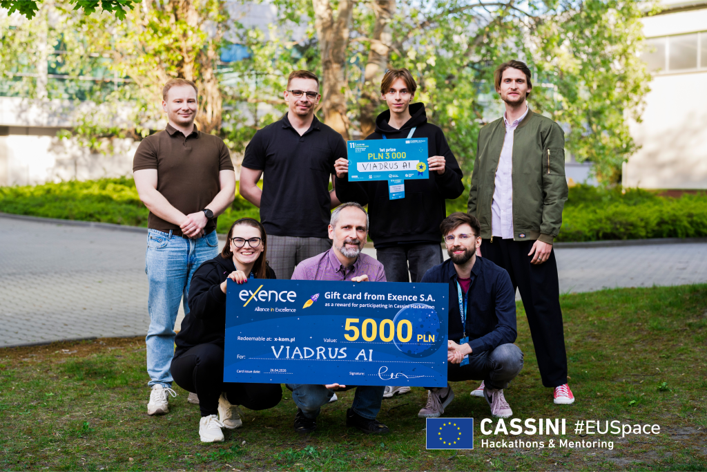
1st Place: Viadrus - Poland
The overall winner is Viadrus AI, a project that uses Sentinel satellite imagery to catch leakages before they become a crisis. The tool was built in collaboration with experts from the Wrocław city water utility company. Watch their pitch.
2nd Place: Blue Pixel - Spain
The silver medal goes to Blue Pixel, a project that demonstrated the power of precision monitoring. By leveraging Sentinel-2 satellite data, the team developed a solution capable of detecting water quality indicators such as turbidity and chlorophyll levels, allowing for the early detection of harmful algae blooms. Watch their pitch.
3rd Place: BasinPulse - Austria
Third on the podium is BasinPulse, a project meant to help companies to understand whether their water protection efforts are actually working. They do so by providing the Basin Health Score, an indicator produced using satellite data as independent, objective evidence. Watch their pitch.
All three winning teams will now continue to develop their solutions through the CASSINI Mentoring Programme, receiving expert guidance to refine their prototypes and accelerate their journey towards real-world applications. Follow their progress and discover future success stories on the EUSPA website, where we will continue to share updates on their achievements and the outcomes of the programme. And if you're ready to take on the next challenge, keep an eye on the upcoming CASSINI Hackathons at CASSINI.eu.
Media note: This feature can be republished without charge provided the European Union Agency for the Space Programme (EUSPA) is acknowledged as the source at the top or the bottom of the story. You must request permission before you use any of the photographs on the site. If you republish, we would be grateful if you could link back to the EUSPA website.