Copernicus for CAP eco-schemes
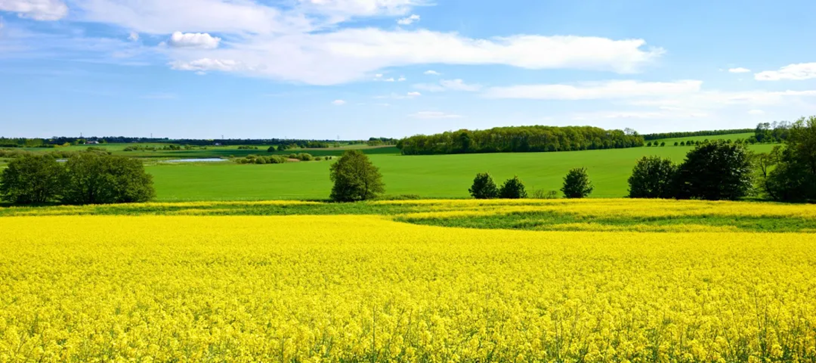
The EU’s Common Agricultural Policy (CAP) introduced the idea of “eco-schemes” in its 2023–2027 reform as a central tool to promote more sustainable farming. Eco-schemes are voluntary programs that reward farmers who adopt environmentally friendly practices that go beyond basic legal requirements. They aim to encourage a transition towards climate-smart, biodiversity-enhancing, and resource-efficient agriculture while maintaining farm income support.
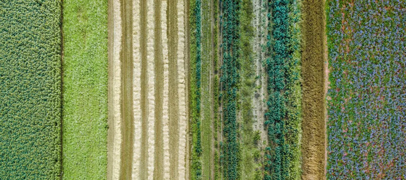
Each EU member state chooses its own set of eco-schemes within the overall CAP framework, tailoring soil health, water quality, carbon sequestration, and wildlife conservation according to local needs. Examples of eco-scheme measures include maintaining permanent grasslands, planting cover crops, reducing pesticide and fertilizer use, establishing pollinator habitats, and practicing organic or agroecological farming. The full list of eligible eco-scheme practices are available here.

Monitoring of CAP eco-schemes by paying agencies is a crucial part of ensuring that farmers comply with the environmental commitments attached to their payments. The European Commission requires member states to have robust systems to verify that the supported practices are implemented and maintained. Paying agencies primarily monitor eco-schemes through a combination of administrative checks, on-the-spot inspections, and increasingly, digital monitoring tools. Administrative checks are often cross-referenced with geospatial data in the Integrated Administration and Control System (IACS), which includes the Land Parcel Identification System (LPIS) — a digital map database of agricultural land.
A major innovation in recent CAP reforms is the use of Area Monitoring Systems (AMS), which rely on satellite imagery from the EU’s Copernicus program to track agricultural activities continuously throughout the year. These systems allow paying agencies to detect practices such as mowing, ploughing, or crop cover changes automatically and in near real time.
This page lists all eco-scheme practices that are monitorable (in whole or in part) via the use of Earth Observation (EO) data. Here we focus primarily on the application of Copernicus data in eco-scheme monitoring. Commercial data sources are, of course, also applicable and can be used alone or in conjunction with Copernicus data.
For each relevant eco-scheme practice, we provide a concise overview of the most relevant Sentinel data, indices derived from EO data, data processing techniques, markers, future Copernicus missions and common challenges experienced when applying EO data. It should be noted that the information listed is not exhaustive, with more indices, techniques, markers etc. also being applicable. Here we try to list the most relevant and commonly used element in eco-scheme monitoring. The eco-scheme practices themselves are grouped by common theme, as per the European Commission taxonomy.
The information presented has been synthesised from consultation interviews with relevant stakeholders and responses gathered from various Paying Agencies via a survey which investigated common applications of EO data and challenges faced in the monitoring of eco-schemes.
A downloadable matrix which outlines the information presented below is also available here.
Organic farming practices are agricultural methods that maintain soil health, biodiversity, and ecological balance by minimising external inputs, reducing synthetic fertilizers and pesticides, and emphasising natural cycles and animal welfare.
Relevant Sentinels
- Sentinel-2
Relevant Indices
- Normalized Difference Vegetation Index (NDVI)
- Leaf Area Index (LAI)
- Bare Soil Index (BSI)
Relevant Data Processing Techniques
- Time Series Analysis
- Object Based Image Analysis (OBIA)
- Data / Multi-sensor Fusion
- Phenological and Productivity Metrics
- Soil Moisture Analytics
- Machine Learning / AI
Relevant Markers
- Land cover marker
- Crop type marker
- Bare soil marker
- Homogeneity marker
Relevant Future Copernicus Missions
- Copernicus Hyperspectral Imaging Mission for the Environment (CHIME)
Typical Challenges / Minimum Monitorable Features, Variables or Activities
Parcel Size and Shape
- Small, narrow, fragmented, and irregular parcels (<0.2 ha) are hard to detect.
- Boundary detection near forests problematic; hedges or wooden strips complicate monitoring.
Spatial Resolution Limitations
- Sentinel imagery resolution too coarse for small features and detailed practices.
Specific Activities
- Differentiating organic from conventional farming is possible only for some crop types.
- Some organic practices (e.g., input use, crop protection) are not directly observable using EO data.
- Certain compliance aspects (e.g., monitoring use of prohibited inputs) are difficult to monitor.
Environmental and Technical Constraints
- Cloudy periods reduce data reliability.
- Snow interrupts vegetation curves.
Relevant Sentinels
- Sentinel-2
Relevant Indices
- Normalized Difference Vegetation Index (NDVI)
- Leaf Area Index (LAI)
- Bare Soil Index (BSI)
Relevant Data Processing Techniques
- Time Series Analysis
- Object Based Image Analysis (OBIA)
- Data / Multi-sensor Fusion
- Phenological and Productivity Metrics
- Soil Moisture Analytics
- Machine Learning / AI
Relevant Markers
- Land cover marker
- Crop type marker
- Bare soil marker
- Homogeneity marker
Relevant Future Copernicus Missions
- Copernicus Hyperspectral Imaging Mission for the Environment (CHIME)
Typical Challenges / Minimum Monitorable Features, Variables or Activities
Parcel Size and Shape
- Small, narrow, fragmented, and irregular parcels (<0.2 ha) are hard to detect.
- Boundary detection near forests problematic; hedges or wooden strips complicate monitoring.
Spatial Resolution Limitations
- Sentinel imagery resolution too coarse for small features and detailed practices.
Specific Activities
- Many organic practices (e.g., input use, crop protection) are not directly observable using EO data.
- Certain compliance aspects (e.g. monitoring use of prohibited inputs) are difficult to monitor.
Environmental and Technical Constraints
- Cloudy periods reduce data reliability.
- Snow interrupts vegetation curves.
Integrated Pest Management practices are sustainable approaches to pest control that combine biological, cultural, physical, and chemical methods to minimise economic, health, and environmental risks while maintaining pest populations at acceptable levels.
- Buffer strips with management practices and without pesticide
- Land lying fallow with species composition for biodiversity purpose
Relevant Sentinels
- Sentinel-1
- Sentinel-2
Relevant Indices
- Normalized Difference Vegetation Index (NDVI)
Relevant Data Processing Techniques
- Time Series Analysis
- Object Based Image Analysis (OBIA)
- Machine Learning / AI
Relevant Markers
- Land cover marker
- Homogeneity marker
Relevant Future Copernicus Missions
- Copernicus Hyperspectral Imaging Mission for the Environment (CHIME)
- Copernicus Radar Observation System for Europe at L-band (ROSE-L)
Typical Challenges / Minimum Monitorable Features, Variables or Activities
Parcel Size and Shape
- Small, narrow, fragmented, and irregular parcels (<0.2 ha) are hard to detect.
- Boundary detection near forests problematic; hedges or wooden strips complicate monitoring.
- Difficulty monitoring biodiversity measures due to fragmented/irregular parcels.
Vegetation and Crop Complexity
- Complex/mixed vegetation, herb-rich grasslands, and buffer strips give inconsistent signals.
Spatial Resolution Limitations
- Sentinel imagery resolution too coarse for small features and detailed practices.
Specific Activities
- Absence of pesticide use difficult to monitor.
- Species composition and biodiversity value difficult to monitor directly.
Environmental and Technical Constraints
- Cloudy periods reduce data reliability.
- Snow interrupts vegetation curves.
Relevant Sentinels
- Sentinel-2
Relevant Indices
- Normalized Difference Vegetation Index (NDVI)
- Bare Soil Index (BSI)
Relevant Data Processing Techniques
- Time Series Analysis
- Phenological and Productivity Metrics
- Machine Learning / AI
Relevant Markers
- Land cover marker
- Crop type marker
- Bare soil marker
- Tillage event marker
- Burning event marker
- Mowing marker
- Homogeneity marker
Relevant Future Copernicus Missions
- Copernicus Hyperspectral Imaging Mission for the Environment (CHIME)
- Copernicus Radar Observation System for Europe at L-band (ROSE-L)
Typical Challenges / Minimum Monitorable Features, Variables or Activities
Parcel Size and Shape
- Small, narrow, fragmented, and irregular parcels (<0.2 ha) are hard to detect.
- Boundary detection near forests problematic; hedges or wooden strips complicate monitoring.
- Difficulty monitoring biodiversity measures due to fragmented/irregular parcels.
Vegetation and Crop Complexity
- Complex/mixed vegetation, herb-rich grasslands, and buffer strips give inconsistent signals.
Spatial Resolution Limitations
- Sentinel imagery resolution too coarse for small features and detailed practices.
Specific Activities
- Absence of pesticide use difficult to monitor.
- Species composition and biodiversity value difficult to monitor directly.
Environmental and Technical Constraints
- Cloudy periods reduce data reliability.
- Snow interrupts vegetation curves.
Agro-ecology is an integrated approach to farming that applies ecological principles to agricultural systems, promoting sustainability, biodiversity, and resilience while supporting social and economic well-being.
- Crop rotation with leguminous crops
- Mixed cropping, multi cropping
- Cover crop between tree rows on permanent crops above conditionality
- Winter soil cover and catch crops above conditionality
- Improved rice cultivation to decrease methane emissions
Relevant Sentinels
- Sentinel-2
Relevant Indices
- Normalized Difference Vegetation Index (NDVI)
- Leaf Area Index (LAI)
- Bare Soil Index (BSI)
Relevant Data Processing Techniques
- Time Series Analysis
- Phenological and Productivity Metrics
- Machine Learning / AI
Relevant Markers
- Land cover marker
- Crop type marker
- Bare soil marker
- Harvesting marker
- Homogeneity marker
Relevant Future Copernicus Missions
- Copernicus Hyperspectral Imaging Mission for the Environment (CHIME)
- Copernicus Radar Observation System for Europe at L-band (ROSE-L)
Typical Challenges / Minimum Monitorable Features, Variables or Activities
Parcel Size and Shape
- Small, narrow, fragmented, and irregular parcels (<0.2 ha) are hard to detect.
- Boundary detection near forests problematic; hedges or wooden strips complicate monitoring.
Vegetation and Crop Complexity
- Complex/mixed vegetation, herb-rich grasslands, and buffer strips give inconsistent signals.
- Difficult to detect vegetation cover in permanent crops.
Spatial Resolution Limitations
- Sentinel imagery resolution too coarse for small features and detailed practices.
- Monitoring of grazing and manure application can be difficult.
- Localized agrotechnical processes difficult to monitor
Specific Activities
- Mixed cropping creates complex spectral signals, making reliable crop identification and monitoring difficult.
- Distinguishing between cover crop species and natural vegetation is difficult.
Environmental and Technical Constraints
- Cloudy periods reduce data reliability.
- Snow interrupts vegetation curves.
- Soil monitoring limitations in case of permanent crops.
Relevant Sentinels
- Sentinel-2
Relevant Indices
- Normalized Difference Vegetation Index (NDVI)
- Leaf Area Index (LAI)
- Bare Soil Index (BSI)
Relevant Data Processing Techniques
- Time Series Analysis
- Phenological and Productivity Metrics
- Object Based Image Analysis (OBIA)
- Machine Learning / AI
Relevant Markers
- Land cover marker
- Crop type marker
- Bare soil marker
- Homogeneity marker
Relevant Future Copernicus Missions
- Copernicus Hyperspectral Imaging Mission for the Environment (CHIME)
- Copernicus Radar Observation System for Europe at L-band (ROSE-L)
Typical Challenges / Minimum Monitorable Features, Variables or Activities
Parcel Size and Shape
- Small, narrow, fragmented, and irregular parcels (<0.2 ha) are hard to detect.
- Boundary detection near forests problematic; hedges or wooden strips complicate monitoring.
Vegetation and Crop Complexity
- Complex/mixed vegetation, herb-rich grasslands, and buffer strips give inconsistent signals.
- Difficult to detect vegetation cover in permanent crops.
Spatial Resolution Limitations
- Sentinel imagery resolution too coarse for small features and detailed practices.
- Monitoring of grazing and manure application can be difficult.
- Localized agrotechnical processes difficult to monitor
Specific Activities
- Mixed cropping creates complex spectral signals, making reliable crop identification and monitoring difficult.
- Distinguishing between cover crop species and natural vegetation is difficult.
Environmental and Technical Constraints
- Cloudy periods reduce data reliability.
- Snow interrupts vegetation curves.
- Soil monitoring limitations in case of permanent crops.
Relevant Sentinels
- Sentinel-2
- Sentinel-3
Relevant Indices
- Normalized Difference Vegetation Index (NDVI)
- Bare Soil Index (BSI)
- Moisture Stress Index (MSI)
- Normalized Difference Moisture Index (NDMI)
Relevant Data Processing Techniques
- Time Series Analysis
- Soil Moisture Analytics
- Machine Learning / AI
Relevant Markers
- Land cover marker
- Crop type marker
- Bare soil marker
- Homogeneity marker
Relevant Future Copernicus Missions
- Copernicus Hyperspectral Imaging Mission for the Environment (CHIME)
- Copernicus Radar Observation System for Europe at L-band (ROSE-L)
Typical Challenges / Minimum Monitorable Features, Variables or Activities
Parcel Size and Shape
- Small, narrow, fragmented, and irregular parcels (<0.2 ha) are hard to detect.
- Boundary detection near forests problematic; hedges or wooden strips complicate monitoring.
Vegetation and Crop Complexity
- Complex/mixed vegetation, herb-rich grasslands, and buffer strips give inconsistent signals.
- Difficult to detect vegetation cover in permanent crops.
Spatial Resolution Limitations
- Sentinel imagery resolution too coarse for small features and detailed practices.
- Localized agrotechnical processes difficult to monitor
Specific Activities
- Mixed cropping creates complex spectral signals, making reliable crop identification and monitoring difficult.
- Distinguishing between cover crop species and natural vegetation is difficult.
- Too short of a catch crop period may mean the presence of the catch crops goes undetected, particularly in cloudy periods.
Environmental and Technical Constraints
- Cloudy periods reduce data reliability.
- Soil monitoring limitations in case of permanent crops.
Relevant Sentinels
- Sentinel-1
- Sentinel-2
Relevant Indices
- Normalized Difference Vegetation Index (NDVI)
- Leaf Area Index (LAI)
- Bare Soil Index (BSI)
Relevant Data Processing Techniques
- Time Series Analysis
- Phenological and Productivity Metrics
- Soil Moisture Analytics
- Machine Learning / AI
Relevant Markers
- Land cover marker
- Crop type marker
- Bare soil marker
- Homogeneity marker
Relevant Future Copernicus Missions
- Copernicus Hyperspectral Imaging Mission for the Environment (CHIME)
- Copernicus Radar Observation System for Europe at L-band (ROSE-L)
Typical Challenges / Minimum Monitorable Features, Variables or Activities
Parcel Size and Shape
- Small, narrow, fragmented, and irregular parcels (<0.2 ha) are hard to detect.
- Boundary detection near forests problematic; hedges or wooden strips complicate monitoring.
Vegetation and Crop Complexity
- Complex/mixed vegetation, herb-rich grasslands, and buffer strips give inconsistent signals.
- Difficult to detect vegetation cover in permanent crops.
Spatial Resolution Limitations
- Sentinel imagery resolution too coarse for small features and detailed practices.
- Monitoring of grazing and manure application can be difficult.
- Localized agrotechnical processes difficult to monitor
Specific Activities
- Differentiating organic from conventional farming is possible only for some crop types.
- Mixed cropping creates complex spectral signals, making reliable crop identification and monitoring difficult.
- Distinguishing between cover crop species and natural vegetation is difficult.
Environmental and Technical Constraints
- Cloudy periods reduce data reliability.
- Snow interrupts vegetation curves.
- Soil monitoring limitations in case of permanent crops.
Agro-forestry is a land-use system that integrates trees and shrubs with crops and/or livestock to enhance biodiversity, improve soil and water quality, and increase overall farm productivity and sustainability.
- Establishment and maintenance of landscape features above conditionality
- Management and cutting plan of landscape features
Relevant Sentinels
- Sentinel-1
- Sentinel-2
Relevant Indices
- Normalized Difference Vegetation Index (NDVI)
- Bare Soil Index (BSI)
Relevant Data Processing Techniques
- Time Series Analysis
- Object Based Image Analysis (OBIA)
- Machine Learning / AI
Relevant Markers
- Land cover marker
- Bare soil marker
- Homogeneity marker
Relevant Future Copernicus Missions
- Copernicus Hyperspectral Imaging Mission for the Environment (CHIME)
- Copernicus Radar Observation System for Europe at L-band (ROSE-L)
Typical Challenges / Minimum Monitorable Features, Variables or Activities
Parcel Size and Shape
- Small, narrow, fragmented, and irregular parcels (<0.2 ha) are hard to detect.
- Boundary detection near forests problematic; hedges or wooden strips complicate monitoring.
Vegetation and Crop Complexity
- Complex/mixed vegetation, trees, herb-rich grasslands, and buffer strips give inconsistent signals.
Spatial Resolution Limitations
- Difficulty in monitoring smaller landscape features (isolated trees, hedges, or wooden strips).
Environmental and Technical Constraints
- Cloudy periods reduce data reliability.
- Snow interrupts vegetation curves.
Relevant Sentinels
- Sentinel-1
- Sentinel-2
Relevant Indices
- Normalized Difference Vegetation Index (NDVI)
Relevant Data Processing Techniques
- Time Series Analysis
- Object Based Image Analysis (OBIA)
- Machine Learning / AI
Relevant Markers
- Land cover marker
- Mowing marker
- Homogeneity marker
Relevant Future Copernicus Missions
- Copernicus Hyperspectral Imaging Mission for the Environment (CHIME)
- Copernicus Radar Observation System for Europe at L-band (ROSE-L)
Typical Challenges / Minimum Monitorable Features, Variables or Activities
Parcel Size and Shape
- Small, narrow, fragmented, and irregular parcels (<0.2 ha) are hard to detect.
- Boundary detection near forests problematic; hedges or wooden strips complicate monitoring.
Vegetation and Crop Complexity
- Complex/mixed vegetation, herb-rich grasslands, and buffer strips give inconsistent signals.
Spatial Resolution Limitations
- Difficulty in monitoring smaller landscape features (isolated trees, hedges, or wooden strips) and/or combinations of different adjacent landscape features.
Environmental and Technical Constraints
- Cloudy periods reduce data reliability.
- Snow interrupts vegetation curves.
High Nature Value (HNV) farming is a type of low-intensity agriculture that sustains high levels of biodiversity and natural habitats by maintaining traditional farming practices and diverse landscapes.
- Land lying fallow with species composition for biodiversity purpose
- Reduction of fertiliser use, low intensity management in arable crops
Relevant Sentinels
- Sentinel-2
Relevant Indices
- Normalized Difference Vegetation Index (NDVI)
- Leaf Area Index (LAI)
Relevant Data Processing Techniques
- Time Series Analysis
- Phenological and Productivity Metrics
- Machine Learning / AI
Relevant Markers
- Land cover marker
- Crop type marker
- Mowing marker
- Tillage event marker
- Burning event marker
- Homogeneity marker
Relevant Future Copernicus Missions
- Copernicus Hyperspectral Imaging Mission for the Environment (CHIME)
Typical Challenges / Minimum Monitorable Features, Variables or Activities
Parcel Size and Shape
- Small, narrow, fragmented, and irregular parcels (<0.2 ha) are hard to detect.
- Boundary detection near forests problematic; hedges or wooden strips complicate monitoring.
Vegetation and Crop Complexity
- Complex/mixed vegetation, herb-rich grasslands, and buffer strips give inconsistent signals.
Specific Activities
- Application of fertilizers difficult to detect.
- Detection of mowing in species-rich grasslands is difficult.
- Monitoring extensive/partial grazing is difficult as vegetation changes are subtle.
- Species composition and biodiversity value difficult to observe directly.
Environmental and Technical Constraints
- Cloudy periods reduce data reliability.
- Snow interrupts vegetation curves.
Relevant Sentinels
- Sentinel-2
Relevant Indices
- Normalized Difference Vegetation Index (NDVI)
- Leaf Area Index (LAI)
Relevant Data Processing Techniques
- Time Series Analysis
- Phenological and Productivity Metrics
- Machine Learning / AI
Relevant Markers
- Land cover marker
- Crop type marker
- Tillage event marker
- Homogeneity marker
Relevant Future Copernicus Missions
- Copernicus Hyperspectral Imaging Mission for the Environment (CHIME)
Typical Challenges / Minimum Monitorable Features, Variables or Activities
Parcel Size and Shape
- Small, narrow, fragmented, and irregular parcels (<0.2 ha) are hard to detect.
- Boundary detection near forests problematic; hedges or wooden strips complicate monitoring.
Vegetation and Crop Complexity
- Complex/mixed vegetation, herb-rich grasslands, and buffer strips give inconsistent signals.
Specific Activities
- Application of fertilizers difficult to detect.
- Detection of mowing in species-rich grasslands is difficult.
- Monitoring extensive grazing is difficult as vegetation changes are subtle.
- Species composition and biodiversity value difficult to observe directly.
Environmental and Technical Constraints
- Cloudy periods reduce data reliability.
- Snow interrupts vegetation curves.
Carbon farming is a set of agricultural practices designed to increase the amount of carbon stored in soil and vegetation while reducing greenhouse gas emissions from farming activities.
- Conservation agriculture
- Establishment and maintenance of permanent grassland
- Extensive use of permanent grassland
Relevant Sentinels
- Sentinel-2
Relevant Indices
- Normalized Difference Vegetation Index (NDVI)
- Leaf Area Index (LAI)
Relevant Data Processing Techniques
- Time Series Analysis
- Machine Learning / AI
Relevant Markers
- Land cover marker
- Tillage event marker
- Homogeneity marker
Relevant Future Copernicus Missions
- Copernicus Hyperspectral Imaging Mission for the Environment (CHIME)
Typical Challenges / Minimum Monitorable Features, Variables or Activities
Parcel Size and Shape
- Small, narrow, fragmented, and irregular parcels (<0.2 ha) are hard to detect.
- Boundary detection near forests problematic; hedges or wooden strips complicate monitoring.
Vegetation and Crop Complexity
- Complex/mixed vegetation, herb-rich grasslands, and buffer strips give inconsistent signals.
Specific Activities
- Differentiating organic from conventional farming is possible only for some crop types.
- Application of manure, fertilizers, pesticides, crop yield enhancers difficult to detect.
- Minimum cultivation techniques (minimal tillage, residue retention) are difficult to detect and monitor.
Single-Day or Short-Term Events
- Mowing, tillage, and harvest often missed if no satellites pass that day.
- Detection of grazing can be difficult (NDVI changes too small).
Environmental and Technical Constraints
- Cloudy periods reduce data reliability.
- Snow interrupts vegetation curves.
Relevant Sentinels
- Sentinel-2
Relevant Indices
- Normalized Difference Vegetation Index (NDVI)
- Leaf Area Index (LAI)
Relevant Data Processing Techniques
- Time Series Analysis
- Machine Learning / AI
Relevant Markers
- Land cover marker
- Mowing marker
- Tillage event marker
- Homogeneity marker
Relevant Future Copernicus Missions
- Copernicus Hyperspectral Imaging Mission for the Environment (CHIME)
Typical Challenges / Minimum Monitorable Features, Variables or Activities
Parcel Size and Shape
- Small, narrow, fragmented, and irregular parcels (<0.2 ha) are hard to detect.
- Boundary detection near forests problematic; hedges or wooden strips complicate monitoring.
Vegetation and Crop Complexity
- Complex/mixed vegetation, herb-rich grasslands, and buffer strips give inconsistent signals.
Specific Activities
- Application of manure, fertilizers, pesticides, crop yield enhancers difficult to detect.
- Minimum cultivation techniques (minimal tillage, residue retention) are difficult to detect and monitor.
Single-Day or Short-Term Events
- Mowing, tillage, and harvest often missed if no satellites pass that day.
- Detection of grazing can be difficult (NDVI changes too small).
Environmental and Technical Constraints
- Cloudy periods reduce data reliability.
- Snow interrupts vegetation curves.
Relevant Sentinels
- Sentinel-2
Relevant Indices
- Normalized Difference Vegetation Index (NDVI)
- Leaf Area Index (LAI)
Relevant Data Processing Techniques
- Time Series Analysis
- Phenological and Productivity Metrics
- Machine Learning / AI
Relevant Markers
- Land cover marker
- Mowing marker
- Tillage event marker
- Burning event marker
- Homogeneity marker
Relevant Future Copernicus Missions
- Copernicus Hyperspectral Imaging Mission for the Environment (CHIME)
Typical Challenges / Minimum Monitorable Features, Variables or Activities
Parcel Size and Shape
- Small, narrow, fragmented, and irregular parcels (<0.2 ha) are hard to detect.
- Boundary detection near forests problematic; hedges or wooden strips complicate monitoring.
Vegetation and Crop Complexity
- Complex/mixed vegetation, herb-rich grasslands, and buffer strips give inconsistent signals.
Specific Activities
- Application of manure, fertilizers, pesticides, crop yield enhancers difficult to detect.
- Minimum cultivation techniques (minimal tillage, residue retention) are difficult to detect and monitor.
Single-Day or Short-Term Events
- Mowing, tillage, and harvest often missed if no satellites pass that day.
- Detection of grazing can be difficult (NDVI changes too small).
Environmental and Technical Constraints
- Cloudy periods reduce data reliability.
- Snow interrupts vegetation curves.
Precision farming is an agricultural management approach that uses technology, data analysis, and automation to optimise inputs and maximise productivity, efficiency, and sustainability in crop and livestock production.
- Nutrients management plan, use of innovative approaches to minimise nutrient release, optimal pH for nutrient uptake, circular agriculture
- Precision crop farming to reduce inputs (fertilisers, water, plant protection products)
- Improving irrigation efficiency
Relevant Sentinels
- Sentinel-2
Relevant Indices
- Normalized Difference Vegetation Index (NDVI)
Relevant Data Processing Techniques
- Time Series Analysis
- Machine Learning / AI
Relevant Markers
- Land cover marker
- Homogeneity marker
Relevant Future Copernicus Missions
- Copernicus Hyperspectral Imaging Mission for the Environment (CHIME)
- Copernicus Land Surface Temperature Monitoring (LSTM)
- Copernicus Radar Observation System for Europe at L-band (ROSE-L)
Typical Challenges / Minimum Monitorable Features, Variables or Activities
Parcel Size and Shape
- Small, narrow, fragmented, and irregular parcels (<0.2 ha) are hard to detect.
- Boundary detection near forests problematic; hedges or wooden strips complicate monitoring.
Vegetation and Crop Complexity
- Complex/mixed vegetation, herb-rich grasslands, and buffer strips give inconsistent signals.
Specific Activities
- Application of manure, fertilizers, pesticides, crop yield enhancers difficult to detect.
- Monitoring precision livestock farming practices, like grazing intensity at parcel level difficult to monitor.
- Difficult to monitor “fine” practices (variable-rate applications, detailed field operations).
Environmental and Technical Constraints
- Cloudy periods reduce data reliability.
- Snow interrupts vegetation curves.
Relevant Sentinels
- Sentinel-2
Relevant Indices
- Normalized Difference Vegetation Index (NDVI)
- Moisture Stress Index (MSI)
- Normalized Difference Moisture Index (NDMI)
Relevant Data Processing Techniques
- Time Series Analysis
- Machine Learning / AI
Relevant Markers
- Land cover marker
- Homogeneity marker
Relevant Future Copernicus Missions
- Copernicus Hyperspectral Imaging Mission for the Environment (CHIME)
- Copernicus Land Surface Temperature Monitoring (LSTM)
- Copernicus Radar Observation System for Europe at L-band (ROSE-L)
Typical Challenges / Minimum Monitorable Features, Variables or Activities
Parcel Size and Shape
- Small, narrow, fragmented, and irregular parcels (<0.2 ha) are hard to detect.
- Boundary detection near forests problematic; hedges or wooden strips complicate monitoring.
Vegetation and Crop Complexity
- Complex/mixed vegetation, herb-rich grasslands, and buffer strips give inconsistent signals.
Specific Activities
- Application of manure, fertilizers, pesticides, crop yield enhancers difficult to detect.
- Monitoring precision livestock farming practices, like grazing intensity at parcel level difficult to monitor.
- Difficult to monitor “fine” practices (variable-rate applications, detailed field operations).
Environmental and Technical Constraints
- Cloudy periods reduce data reliability.
- Snow interrupts vegetation curves.
Relevant Sentinels
- Sentinel-1
- Sentinel-2
Relevant Indices
- Normalized Difference Vegetation Index (NDVI)
- Bare Soil Index (BSI)
- Moisture Stress Index (MSI)
- Normalized Difference Moisture Index (NDMI)
Relevant Data Processing Techniques
- Time Series Analysis
- Soil Moisture Analytics
- Machine Learning / AI
Relevant Markers
- Land cover marker
- Bare soil marker
- Artificial surface marker
- Homogeneity marker
Relevant Future Copernicus Missions
- Copernicus Hyperspectral Imaging Mission for the Environment (CHIME)
- Copernicus Land Surface Temperature Monitoring (LSTM)
- Copernicus Radar Observation System for Europe at L-band (ROSE-L)
Typical Challenges / Minimum Monitorable Features, Variables or Activities
Parcel Size and Shape
- Small, narrow, fragmented, and irregular parcels (<0.2 ha) are hard to detect.
- Boundary detection near forests problematic; hedges or wooden strips complicate monitoring.
Vegetation and Crop Complexity
- Complex/mixed vegetation, herb-rich grasslands, and buffer strips give inconsistent signals.
Specific Activities
- Application of manure, fertilizers, pesticides, crop yield enhancers difficult to detect.
- Monitoring precision livestock farming practices, like grazing intensity at parcel level difficult to monitor.
- Difficult to monitor “fine” practices (variable-rate applications, detailed field operations).
Environmental and Technical Constraints
- Cloudy periods reduce data reliability.
- Snow interrupts vegetation curves.
Protecting water resources in agriculture means managing farming practices to prevent water pollution, manage crop water demand, reduce wastage, and maintain the quality and availability of surface and groundwater for ecosystems and human use.
Relevant Sentinels
- Sentinel-1
- Sentinel-2
- Sentinel-3
Relevant Indices
- Normalized Difference Vegetation Index (NDVI)
- Bare Soil Index (BSI)
- Moisture Stress Index (MSI)
- Normalized Difference Moisture Index (NDMI)
Relevant Data Processing Techniques
- Time Series Analysis
- Soil Moisture Analytics
- Machine Learning / AI
Relevant Markers
- Land cover marker
- Bare soil marker
- Homogeneity marker
Relevant Future Copernicus Missions
- Copernicus Hyperspectral Imaging Mission for the Environment (CHIME)
- Copernicus Land Surface Temperature Monitoring (LSTM)
- Copernicus Radar Observation System for Europe at L-band (ROSE-L)
Typical Challenges / Minimum Monitorable Features, Variables or Activities
Parcel Size and Shape
- Small, narrow, fragmented, and irregular parcels (<0.2 ha) are hard to detect.
- Boundary detection near forests problematic; hedges or wooden strips complicate monitoring.
Specific Activities
- Optimised application of water difficult to detect
- Nutrient leaching or fertilizer runoff difficult to detect
Environmental and Technical Constraints
- Cloudy periods reduce data reliability.
- Snow interrupts vegetation curves.
Practices beneficial for soil are farming methods that enhance soil health, structure, and fertility by increasing organic matter, preventing erosion, and promoting biodiversity and nutrient cycling.
- Erosion prevention strips and wind breaks
- Establishment or maintenance of terraces and strip cropping
Relevant Sentinels
- Sentinel-1
- Sentinel-2
Relevant Indices
- Normalized Difference Vegetation Index (NDVI)
- Bare Soil Index (BSI)
Relevant Data Processing Techniques
- Time Series Analysis
- Object Based Image Analysis (OBIA)
- Machine Learning / AI
Relevant Markers
- Land cover marker
- Bare soil marker
- Artificial surface marker
- Homogeneity marker
Relevant Future Copernicus Missions
- Copernicus Hyperspectral Imaging Mission for the Environment (CHIME)
- Copernicus Radar Observation System for Europe at L-band (ROSE-L)
Typical Challenges / Minimum Monitorable Features, Variables or Activities
Parcel Size and Shape
- Small, narrow, fragmented, and irregular parcels (<0.2 ha) are hard to detect.
- Boundary detection near forests problematic; hedges or wooden strips complicate monitoring.
Spatial Resolution Limitations
- Sentinel imagery resolution too coarse for small features and detailed practices.
- Distinguishing between permanent vegetation cover (grasses, cover crops, legumes) and wind break features is resolution‑limited.
Environmental and Technical Constraints
- Cloudy periods reduce data reliability.