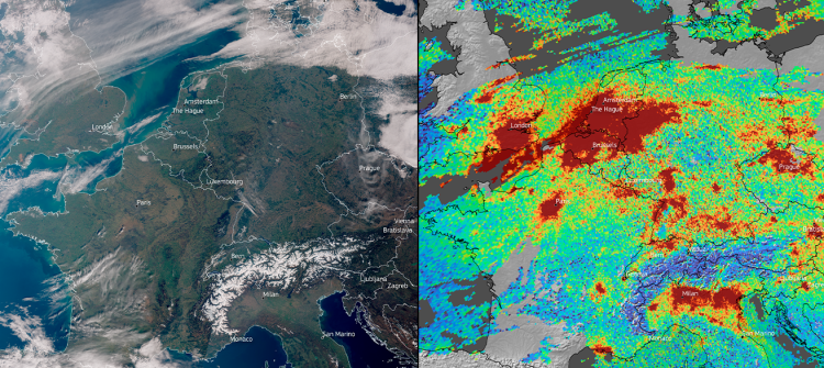
Climate Services

Implementing fuel-efficient flight paths, monitoring CO2 emissions and providing long-term forecasting are just a few examples of how the EU Space Programme helps mitigate the risks of climate change. Specifically, researchers use Copernicus’ historic datasets to monitor changes in sea levels, permafrost and the icecaps and to build better forecasting models. Climate scientists also use GNSS to measure vegetation and soil moisture, which further support climate modelling.

Climate Services In Action

Image
The aurora borealis displays vibrant colors in the night sky, caused by solar rays interacting with the Earth's atmosphere.

EU Space, and Copernicus data in particular, is being used for everything from sustainable research in Svalbard to helping ships avoid icebergs when navigating the Arctic Ocean.

Image
blue banner with the text: winners of the idea track

From enabling sustainable livestock grazing to monitoring urbanisation and helping autonomous vehicles avoid collision – all 15 of the CASSINI Challenges winning ideas have one thing in common: each leverages the power of EU Space.

Image
The Cassini Challenge is looking for innovative, space-based solutions and ideas ready to help solve some of today’s most pressing issues.

The CASSINI Challenges competition is looking for innovative, space-based solutions ready to help solve some of today’s most pressing issues.

Image
2023 was an eventful year for EUSPA thanks to milestones such as the EU SST takeover or the implementation of Galileo HAS

It’s the last month of the year, which can only mean one thing: time for EUSPA’s annual recap.